-CUNL%20CREDIT%20MarshallIslandsPocketGuide.com.webp?v=2026-07-08T19%3A45%3A47.332Z)
Where is the Marshall Islands?
Discovering the Marshall Islands has to start somewhere and its location is as good as any…
So, where is the Marshall Islands located? The Marshall Islands is a country in Oceania, located in the central Pacific Ocean. It sits in the region of Micronesia, about 2,300 mi (3,700 km) southwest of Hawai‘i and huddled among other Pacific island nations and territories, such as the Federated States of Micronesia, Kiribati, Nauru and Wake Island.
The Marshall Islands is made up of 29 coral atolls and five islands, with a total land area of around 70 mi² (181 km²).
We’ll go through all that and more in this quick guide answering the question, where is the Marshall Islands located?
This article is based on real on-the-ground research, not on AI scraping old content from the internet. Learn how we use AI!
Table of Contents
Quick Facts About the Marshall Islands
- Population: 42,418 (2021 census)
- Landmass: 70 mi² (181 km²)
- Languages: Marshallese and English
- Capital: Majuro
- Currency: United States dollar
- Famous for: Coral atolls, vast lagoons, World War Two history, traditional outrigger canoes, Marshallese culture and Bikini Atoll.
Where is the Marshall Islands on the World Map?
The Marshall Islands is located on the Oceania continent in the Northern Hemisphere. The country is situated in the central Pacific Ocean, about 2,300 mi (3,700 km) southwest of Hawai‘i and around 500 mi (800 km) north of the Equator.
The Marshall Islands is part of Micronesia, a subregion of Oceania made up of small island nations and territories scattered across the western and central Pacific.
The Pacific Islands Near the Marshall Islands
The Marshall Islands is also situated near other Pacific islands and nations, with Kiribati around 410 mi (660 km) to the south, Nauru around 610 mi (980 km) to the southwest, the Federated States of Micronesia around 900 mi (1,450 km) to the west and Wake Island around 900 mi (1,450 km) to the northwest.
-IC%26C%20CREDIT%20MarshallIslandsPocketGuide.com-900x601.webp?v=2026-07-07T21%3A08%3A49.715Z)
How Big Is the Marshall Islands?
The Marshall Islands covers a land area of approximately 70 mi² (181 km²).
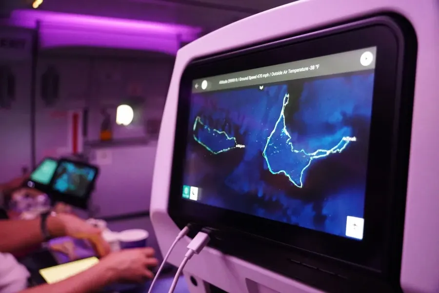
Rather than being made up of one or two large islands, the Marshall Islands consists of 29 coral atolls and five islands spread across two main island chains: the Ratak Chain in the east and the Ralik Chain in the west.
The capital, Majuro, sits on Majuro Atoll, while other well-known atolls include Kwajalein Atoll, Bikini Atoll and Enewetak Atoll.
Learn more about the islands in our guide, The Atolls of the Marshall Islands & The Best to Visit.
-SEB%20CREDIT%20MarshallIslandsPocketGuide.com.webp?v=2026-07-09T18%3A30%3A04.823Z)
Geography of the Marshall Islands
The Marshall Islands is made up of low-lying coral atolls and islands, rather than high volcanic islands. These are spread across two main island chains: the Ratak Chain to the east and the Ralik Chain to the west.
Altogether, the country has 29 coral atolls and five islands, scattered across a vast area of the central Pacific Ocean. Some of the best-known atolls include Majuro Atoll, where the capital is located, Kwajalein Atoll, Bikini Atoll and Enewetak Atoll. Check out The Atolls of the Marshall Islands & The Best to Visit to learn more about the country's geography.
The Marshall Islands is famously flat, with narrow strips of land surrounding lagoons. The nation’s highest point is only around 33 ft (10 m) above sea level, which is quite the contrast to the dramatic peaks found on many other Pacific islands.
Frequently Asked Questions About the Location of the Marshall Islands
Finally, here are the answers to some of the most popular questions on the internet about the location of the Marshall Islands.
Where Are the Marshall Islands Located?
The Marshall Islands are located in the central Pacific Ocean in the continent of Oceania. More specifically, they are part of Micronesia and sit north of the Equator.
What Country Do the Marshall Islands Belong To?
The Marshall Islands is an independent country. It is a sovereign nation in free association with the United States, but it does not “belong” to the US.
Learn more about the politics of the islands in A Traveller's Guide to the Marshallese Culture.
What Is the Physical Geography of the Marshall Islands?
The physical geography of the Marshall Islands is low-lying coral atolls and islands, with narrow strips of land surrounding large lagoons.
Are the Marshall Islands Part of Micronesia?
Yes, the Marshall Islands is part of Micronesia, a subregion of Oceania made up of island nations and territories in the western and central Pacific.
Why Is the Marshall Islands Often Mentioned in Climate Change Discussions?
The Marshall Islands is often mentioned in climate change discussions because it is made up of low-lying coral atolls, with its highest point only around 33 ft (10 m) above sea level.
That means rising sea levels and stronger coastal flooding are especially important issues here. It’s a small country on the map, but it has become a big voice in global climate conversations.
More About Where the Marshall Islands in Located
That’s it for our guide on where the Marshall Islands is located but by no means the end of our interesting facts about the islands. In fact, we have more articles for your reading pleasure:
- Marshallese Etiquette: the Marshall Islands Customs & Traditions
- 10 Fun Facts About the Marshall Islands
- 15 Free & Cheap Things to Do in the Marshall Islands
And if you’re planning a trip to the Marshall Islands, don’t miss our 30 Tips for Travelling in the Marshall Islands.

-SEB%20CREDIT%20MarshallIslandsPocketGuide.com-900x633.webp?v=2026-07-23T03%3A25%3A07.979Z)