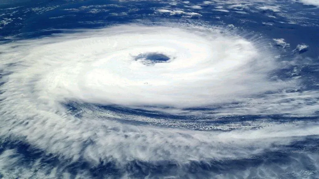
What You Need to Know About Typhoons in the Marshall Islands
Tropical cyclones, known as typhoons in the western North Pacific, can occasionally impact the Marshall Islands. The main typhoon risk is generally during the wet months (May to November), when tropical storms are more likely to form or pass through the region.
Although severe typhoons are not an everyday occurrence, it’s wise to prepare and know what to do should a typhoon warning be issued. The Marshall Islands is made up of low-lying coral atolls, so strong winds, storm surge, coastal flooding, heavy rain, rough seas and travel disruption are the main things to take seriously.
The key advice is simple: stay alert, follow official warnings, listen to local authorities and ask your accommodation what to do if severe weather is forecast. Don’t let the typhoon risk deter your trip; just be prepared and avoid taking silly risks when the weather turns (the lagoon views can wait).
For more detailed seasonal insights, check out our Marshall Islands Weather, Seasons & Climate + Weather by Month guide.
This article is based on real on-the-ground research, not on AI scraping old content from the internet. Learn how we use AI!
Table of Contents
When Is the Typhoon Season in the Marshall Islands?
The typhoon season in the Marshall Islands is generally associated with the wet months, with the highest risk of tropical storms and typhoons usually from around May to November.
That said, the Marshall Islands is in the western North Pacific, where tropical storms can occasionally develop outside these months, so it’s always worth checking the weather forecast before and during your trip.
The peak months for typhoon risk are typically later in the season, when sea temperatures are warm, and storm activity in the region is more likely.
There can also be changes in storm patterns during an El Niño year, so keep an eye on official weather alerts if you’re travelling during the wetter season.
-SEB%20CREDIT%20WallisandFutunaPocketGuide.com-900x601.webp?v=2026-04-11T21%3A17%3A23.806Z)
Typhoon Warnings in the Marshall Islands
The Marshall Islands' typhoon season runs from May to November, and a network of agencies closely monitors potential storms.
The National Weather Service Weather Forecast Office in Guam issues official tropical storm and typhoon watches and warnings for the Marshall Islands. Formal warning points include Enewetak, Ujae, Kwajalein, Ailinglaplap, Jaluit, Wotje, Utirik, Majuro and Mili.
The Majuro Weather Service Office provides local weather observations, forecasts and information for the Marshall Islands.
Meanwhile, the Republic of the Marshall Islands National Disaster Management Office, commonly shortened to NDMO, helps coordinate the distribution of disaster warnings, preparedness measures and emergency response.
The Joint Typhoon Warning Center also produces technical forecasts showing a cyclone’s expected track and intensity. These forecasts support regional monitoring, while the National Weather Service in Guam provides public advisories and island-specific warnings.
How Typhoons Are Reported
What is the difference between a watch and a warning? A "watch" means that dangerous winds are possible, while a "warning" means they are expected.
The general warning periods used for the Marshall Islands are:
- Tropical Storm Watch - Sustained winds of 39–73 mph (63–118 kph) are possible, usually within 48 hours.
- Tropical Storm Warning - Sustained winds of 39–73 mph (63–118 kph) are expected, usually within 24 hours.
- Typhoon Watch - Sustained winds of at least 74 mph (119 kph) are possible, usually within 48 hours.
- Typhoon Warning - Sustained winds of at least 74 mph (119 kph) are expected, usually within 24 hours.
Public advisories normally become more frequent when an island is under a watch or warning. Local statements may include information about expected winds, rainfall, high surf, storm surge, coastal inundation and recommended preparations.
Storms can change direction or intensity quickly, so always follow the most recent advisory rather than relying on a forecast issued the previous day.
-IC%26C%20CREDIT%20MarshallIslandsPocketGuide.com-900x601.webp?v=2026-07-09T18%3A48%3A42.332Z)
The Dangers of Typhoons
Why do you need to prepare for a typhoon? Strong winds can damage weaker buildings, power lines, trees and communication systems, while flying debris can make it dangerous to be outside during the storm.
In the Marshall Islands, one of the biggest risks is coastal flooding. Because the country is made up of low-lying coral atolls, storm surge and large waves can wash across roads, homes and causeways, especially in exposed coastal areas. Rough seas can also disrupt boat travel between islands, fishing trips and flights.
Another danger can be contaminated drinking water (and the surrounding waters for swimming). Heavy rain, flooding or saltwater intrusion can affect rainwater tanks, wells and other local water supplies. We recommend filtering or boiling tap water in the Marshall Islands unless you know your accommodation is treating the water. See Is the Water Safe to Drink in the Marshall Islands? for more advice.
It’s also important to note that typhoon damage can be localised, affecting the islands or atolls in the storm’s path more severely than other parts of the country. That said, because the Marshall Islands is so low-lying, even a passing storm can cause coastal flooding, rough seas and travel disruption, so it’s worth taking warnings seriously.
How to Prepare for a Typhoon
If you’re visiting the Marshall Islands during the wet months or wider typhoon season, one of the best things you can do is stay on top of local weather alerts. Typhoons can change track and intensity, so yesterday’s “probably fine” forecast is not something to build your beach day around.
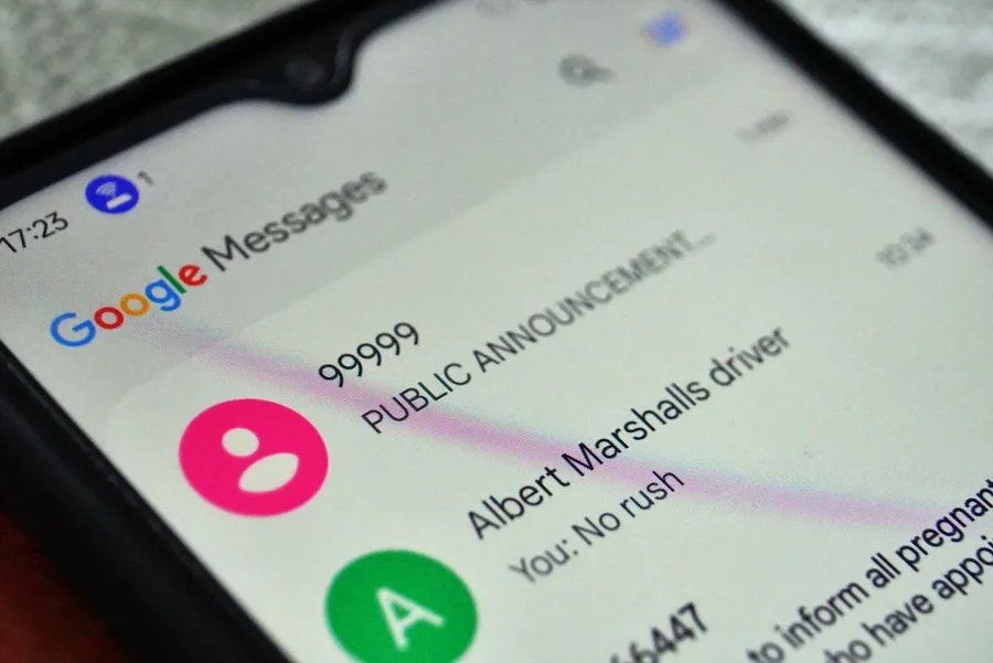
Follow updates from official weather services, local authorities, your airline and your accommodation provider. If you have a local SIM card, severe weather alerts and instructions from the Marshall Islands Government are sent via mass text message. Learn more about getting a local SIM in The Best SIM Card in the Marshall Islands for Travellers.
If you’re staying in a hotel, guesthouse or with local hosts, ask about their typhoon procedure as soon as severe weather is forecast. They’ll be able to advise on the safest part of the building, whether travel plans need to change and what to do if flooding or strong winds are expected.
Given how low-lying the Marshall Islands is, it’s always better to be overprepared than underprepared. Storm surge, coastal flooding, heavy rain, rough seas and power cuts can all cause disruption, even if the centre of the storm does not pass directly overhead.
Prepare a basic emergency kit with drinking water, non-perishable food, clothing, medication and essential toiletries for at least three days. It’s also helpful to have a fully charged power bank, torch, spare batteries, copies of important documents and some cash in case card payments or ATMs are affected.
Keep your phone charged and follow the progress of the typhoon through radio, local news, official text message alerts, your accommodation and airline updates. You’ll be informed if evacuation or sheltering in place is necessary.
In an emergency in the Marshall Islands, call 911. If you are travelling outside Majuro or visiting outer atolls, ask your accommodation or local host for the nearest clinic, police station or emergency contact, as services and response times can be more limited.
A History of Typhoons in the Marshall Islands
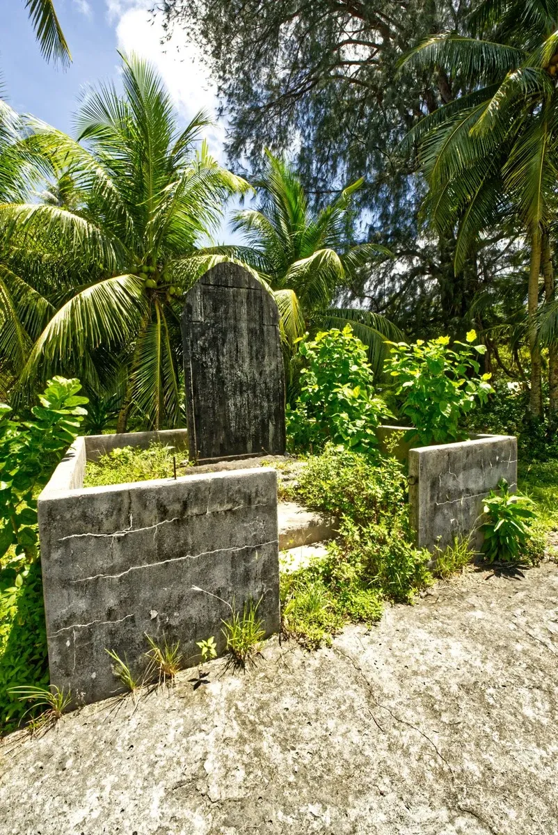
While the Marshall Islands sit east of the main western North Pacific typhoon belt, tropical cyclones and developing tropical disturbances have occasionally affected the country’s low-lying atolls. The systems listed below include typhoons, tropical storms and tropical depressions that brought damaging winds, flooding, storm surge, crop losses and coastal damage to parts of the Marshall Islands.
Below is a record of notable tropical cyclones that have affected the Marshall Islands.
Typhoon Alice
Forming unusually close to the equator, Typhoon Alice affected the Marshall Islands in January 1979. The storm moved erratically through the country, bringing heavy rain and gusty winds that destroyed crops across the archipelago. Significant damage was reported in Majuro and Enewetak Atoll, where gusts reached 80 mph (130 kph), one person was injured and nuclear cleanup operations were disrupted. Damage was estimated at US$50,000-$500,000.
Tropical Storm Zelda
On 28 November 1991, Tropical Storm Zelda struck the Marshall Islands, producing sustained winds of 75-100 mph (120-160 kph). The storm caused major damage on Ebeye Island, where around 60% of homes were destroyed and about 6,000 people were left without residence. Saltwater contaminated food and water supplies, power lines were cut and around 95% of crops were destroyed, though no deaths or serious injuries were reported.
Tropical Storm Axel
Described as the worst cyclone to hit the country in more than 70 years, Tropical Storm Axel affected the Marshall Islands in January 1992. Majuro recorded gusts of 53 mph (85 kph), almost 10 in (250 mm) of rain in a day and a storm surge of 13-16 ft (4-4.9 m), which contaminated water supplies and damaged infrastructure. The storm flooded homes and cars, damaged airport areas and left many residents homeless.
Typhoon Paka
Entering the Marshall Islands between Mili and Majuro as a tropical storm before strengthening into a typhoon, Typhoon Paka crossed the country in December 1997. Majuro and Kwajalein recorded gusts above 47 mph (75 kph), while Jaluit Atoll received around 12 in (300 mm) of rain in 30 hours. Strong waves flooded low-lying islands, crops were damaged by saltwater, 70% of homes on Ailinglaplap Atoll were damaged, and total damage in the Marshall Islands was estimated at US$80 million.
Tropical Storm Bavi
Forming near the Marshall Islands in March 2015, Tropical Storm Bavi moved northwest through the country as it developed. The system brought strong to gale-force winds of 30-40 mph (45-65 kph) to several atolls. Considerable damage was reported on Ebeye, while tree damage and unsafe old steel structures were reported around Kwajalein. Damage in the Marshall Islands was estimated at US$2.1 million, and a fishing vessel with nine crew members was reported missing.
Typhoon Nangka
Beginning as a tropical disturbance over the Marshall Islands in July 2015, Typhoon Nangka went on to become a powerful typhoon farther west. In its early stages, the developing storm brought strong westerly winds, high waves and lagoon flooding to Majuro. Around half of the capital lost power, several boats sank or broke loose from their moorings, roofs were torn from homes, trees and power lines were downed, and some crop damage was reported.
Tropical Depression Amang
Listed among systems affecting Kiribati, the Marshall Islands, the Caroline Islands and the Philippines, Tropical Depression Amang formed northeast of the Gilbert Islands in January 2019. It was a weak but long-lived tropical depression, with peak winds of 35 mph (55 kph), and later redeveloped near the Philippines, where it caused flooding, landslides and fatalities.
Typhoon History in the Marshall Islands, Month-by-Month
- January: 1979 (Alice), 1992 (Axel), 2019 (Amang)
- March: 2015 (Bavi)
- July: 2015 (Nangka)
- November: 1991 (Zelda)
- December: 1997 (Paka).
Frequently Asked Questions About Typhoons in the Marshall Islands
Now that you know about typhoons in the Marshall Islands, here are the answers to the internet’s frequently asked questions about staying safe during storm season!
When is typhoon season in the Marshall Islands?
Typhoons can form in the western North Pacific at different times of the year, but the Marshall Islands is most likely to experience tropical storms, heavy rain and rough seas during the wetter months from May to November.
Are typhoons common in the Marshall Islands?
Direct hits from full-strength typhoons are less frequent than they are farther west in Micronesia and Asia.
Nevertheless, the Marshall Islands is extremely vulnerable to coastal flooding because of its low-lying geography. Tropical storms and depressions can still bring damaging winds, heavy rain, saltwater intrusion, rough seas and travel disruption.
Who Issues Typhoon Warnings for the Marshall Islands?
Official tropical storm and typhoon watches and warnings are issued by the National Weather Service Weather Forecast Office in Guam.
The Majuro Weather Service Office provides local observations and forecasts, while the Republic of the Marshall Islands National Disaster Management Office coordinates warning dissemination, preparedness and emergency response.
What Is the Difference Between a Typhoon Watch and a Typhoon Warning?
A typhoon watch means that winds of at least 74 mph (119 kph) are possible, usually within 48 hours.
A typhoon warning means that winds of at least 74 mph (119 kph) are expected, usually within 24 hours.
A warning therefore requires more immediate action, but preparations should begin as soon as a watch is issued.
How Can I Stay Informed During a Typhoon?
Check updates from the National Weather Service in Guam, the Majuro Weather Service Office and the National Disaster Management Office.
You should also listen to local radio, follow instructions from your accommodation and check directly with your airline or boat operator.
Keep your phone and power bank charged and have a battery-powered radio available. Do not rely on internet access or mobile service remaining available throughout the storm.
What Should Travellers Do if a Typhoon Warning Is Issued?
Follow the instructions of local authorities, the National Disaster Management Office and your accommodation.
Remain away from the sea, beaches and exposed coastal roads. Cancel swimming, snorkelling, diving, fishing and boat trips.
Keep your passport, medication, cash, phone and travel documents in a waterproof bag. Prepare for flight, boat and tour cancellations and do not travel until the relevant operator confirms that conditions are safe.
Can Flights and Boats Operate During a Typhoon?
Flights, inter-atoll boats and tours may be cancelled before the worst weather arrives.
Even after a warning is lifted, services may remain suspended while operators inspect aircraft, boats, runways, docks or navigation routes. Contact the operator directly before leaving for the airport or dock.
Is It Safe to Drink the Water After a Typhoon?
Flooding, heavy rain and saltwater intrusion may affect rainwater tanks, wells and other supplies.
Follow local advice and ask your accommodation whether its drinking water remains safe. Use bottled, boiled or properly treated water if there is any uncertainty.
For more information, see Is the Water Safe to Drink in the Marshall Islands?
More About Typhoons in the Marshall Islands
That's it for our complete guide to typhoons in the Marshall Islands and how to prepare. For more about natural disasters and safety in the Marshall Islands, take a look at the following guides:
- The Guide to Tsunamis & Earthquakes in the Marshall Islands
- Marshall Islands Safety Tips: Is it Safe to Travel to the Marshall Islands?
- Marshall Islands Weather, Seasons & Climate + Marshall Islands Weather by Month
Finally, get all of the tips required for a smooth getaway to the islands from our 30 Tips for Travelling in the Marshall Islands.

-SEB%20CREDIT%20MarshallIslandsPocketGuide.com-900x633.webp?v=2026-07-23T03%3A25%3A07.979Z)