

Discover Majuro and the Marshall Islands' Most Fascinating Historical Landmarks
With a history shaped by Marshallese traditions, Japanese and American occupation, the Second World War, independence and the nuclear age, the Marshall Islands has a remarkable collection of landmarks that bring its past into sharp focus.
Across Majuro, roadside wells and cultural sites preserve stories of survival, community and local legend, while bunkers, memorials and the site of the nation’s first presidential inauguration reveal more recent chapters.
Find a hidden Japanese air raid shelter, the storied LiModrel’s Well, fascinating displays at the Alele Museum and the haunting nuclear legacy of Bikini Atoll in this list of the best historical sites in the Marshall Islands.
This article is based on real on-the-ground research, not on AI scraping old content from the internet. Learn how we use AI!
Table of Contents
1.Japanese Air Raid Shelter (Majuro)
%20CREDIT%20MarshallIslandsPocketGuide.com-900x601.webp?v=2026-07-08T19%3A46%3A41.445Z)
Hiding in plain sight behind a purple house in Rita, the Japanese Air Raid Shelter is the only intact WW2 bunker on Majuro and one of the least-known historical sites in the Marshall Islands.
Built during the Pacific build-up to protect Japanese troops from pre-invasion bombardments, this heavily reinforced concrete personnel shelter was part of the defence network around the Djarrit Seaplane Base. It features a central corridor connecting two square observation holes at each end, blast barriers at the steel door entry and an alternate escape door at the back; similar shelters exist at Northfield Air Base in Tinian and Aslito Field in Saipan, but few survive as intact as this one.
The shelter sits on private land, so it's always polite to knock and ask permission before visiting. The owners typically keep it closed to discourage children from playing inside, but show genuine interest and they'll usually open it up for you.
Be aware that WW2-era live ammunition has been found at sites like this across the islands, so look, don't touch.
Rita (Mosquito Town), Majuro. From the Lagoon Road, turn onto the road of the Salvation Army. Opposite the Salvation Army, take the driveway on the left side of the purple house; the bunker is behind the parking area.
2.LiModrel's Well (Majuro)
-SEB%20CREDIT%20MarshallIslandsPocketGuide.com-900x601.webp?v=2026-07-09T18%3A29%3A03.676Z)
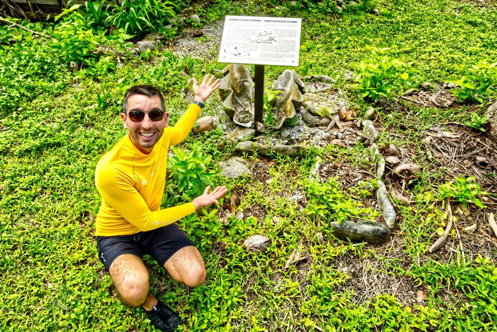
Along the Lagoon Road on the way to Laura, LiModrel's Well is a small but historically significant stop.
The land here, called Ņamwijel Wāto on what was once the Wōja Islet, was an important meeting place for Majuro Atoll and the home of LiModrel, a woman celebrated for her beauty and skill in weaving traditional clothing from pandanus leaves.
After a devastating 1905 typhoon wiped out most of Majuro's coconut trees and freshwater wells, the community came together to replant the island. When LiModrel's husband, Makpi, spotted two birds (kolej) drinking from a small hole, he discovered a freshwater source that never ran dry, estimated to hold over five million gallons.
An interpretation sign on the roadside tells the full story; it's well worth a few minutes of your time.
Lagoon Road, Wōja, Majuro. Look out for the interpretation sign on the roadside, approximately 0.8 mi (1.4 km) south of HNR Letora Handicraft.
3.Bōkjānwūt (Majuro)
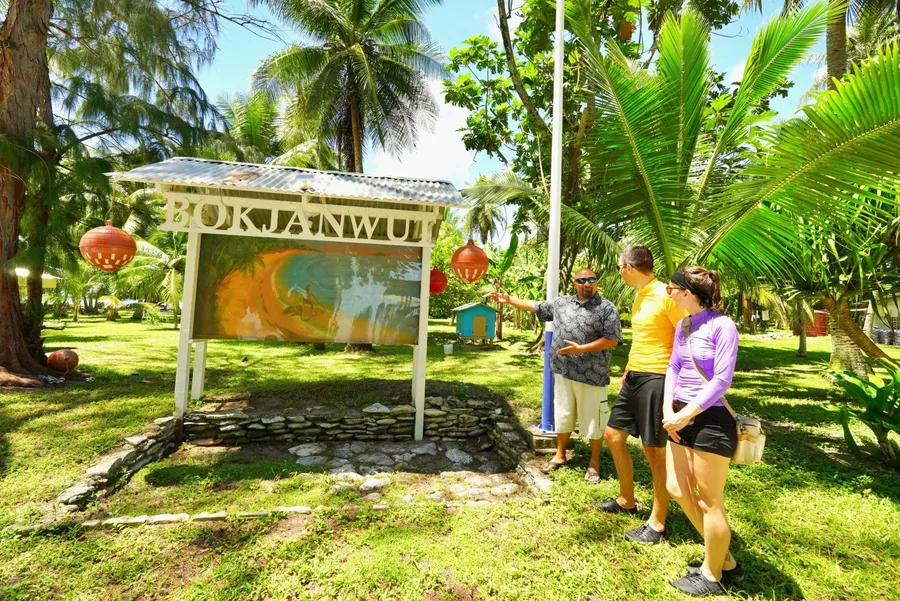
Tucked within the wāto (land parcel) of M̧weituwaak near the sandy shores of Laura Beach, Bōkjānwūt is one of the Marshall Islands' most captivating cultural and historic sites, steeped in Marshallese legend.
The site centres on a shallow groundwater well said to be where the young Bōkjānwūt transformed his mother, Likijdrik (the she-rat), into a beautiful woman using a chant and coconut milk, after a chance encounter with the son of irooj (chief) Jemāluut led to an unforgettable canoe race.
The legend is as rich as it is memorable, weaving together themes of disobedience, identity and transformation in a way that feels distinctly Marshallese.
Although the rocks might not look like much from the ground, if you get a view from above, locals say you can see the outline of the rat lady. Though we also recommend climbing the coconut trees to the experts. Whether or not you spot her, the experience is genuinely otherworldly.
Laura Beach, Laura, western point of Majuro. After you have paid your entry fee at Laura Beach, look out for the Bōkjānwūt sign and mural along the roadside near the showers and bathrooms.
4.Japanese Peace Park (Majuro)
%20CREDIT%20MarshallIslandsPocketGuide.com-900x601.webp?v=2026-07-09T18%3A27%3A43.828Z)
Japanese Peace Park is one of Majuro's most quietly moving stops.
The memorial was constructed by the Japanese government in 1984 to honour all those who lost their lives in the islands and seas of the East Pacific during World War Two.
Located just past the airport on the road towards Laura, the park features some of the last large preserved trees on Majuro, concrete seating and a solemn memorial inscription dedicated to world peace.
Beyond its role as a commemorative site, the park has served as a ceremonial site for the cremated remains of fallen Japanese Imperial Soldiers before their repatriation home, a process the Japanese government continues to undertake in cooperation with Marshallese authorities.
It's a reflective, shaded spot with genuine historical weight, though it's worth noting that litter can be an issue.
Lagoon Road, Majuro. Approximately 1.7 mi (2.7 km) west of the runway on the road to Laura.
5.Typhoon Memorial (Majuro)
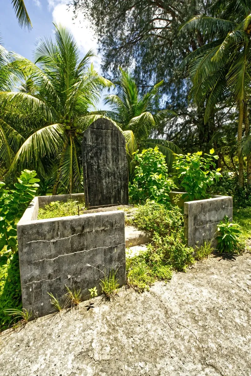
Standing quietly near the lagoon-side road at the western end of Majuro, the 1918 Typhoon Monument is one of the most historically significant and sobering stops in the Marshall Islands.
This weathered sandstone marker in Laura Village commemorates the devastating typhoon that struck on 8 November 1918, bringing unprecedented tidal waves and fierce winds that claimed over 200 lives, making it the deadliest storm in Marshallese history.
At the time, the Marshall Islands were under Japanese rule, and the monument also pays homage to Emperor Taisho, who donated private funds to help the islanders rebuild their destroyed coconut plantations.
The monument is a little unkempt today, with the Japanese writing only just visible through years of weathering, which, if anything, adds to its quiet, melancholy atmosphere. It won't take long to visit, but it will stay with you.
Lagoon Road, Laura, Majuro. Approximately 270 yards (250 m) north of the Laura Ball Field.
6.Jikin Jekjek Wa Eṇ (Majuro)
-SEB%20CREDIT%20MarshallIslandsPocketGuide.com-900x601.webp?v=2026-07-09T18%3A27%3A58.077Z)
Jikin Jekjek Wa Eṇ is a roadside cultural heritage site on Majuro tied to one of the Marshall Islands' most enduring legends: the story of Ļetao, the trickster who carved his outrigger canoes right here.
According to legend, Ļetao built a canoe for Majuro's irooj (chief) using kōñe, a plant sometimes referred to as ironwood. The site once held a Nōōt (a shallow coral reef area where he sharpened his tools), a Bwewa (coconut tree trunks used to support the canoe hull) and Lānm̧ōjānjān (wooden supports to hold the hull in place).
These artefacts have since been buried beneath the land's surface, so today all that marks the spot is a roadside sign and an illustrated panel backed by bush. You'll need to bring your imagination, but the legend itself makes it worth the stop.
Lagoon Road, Wōja, Majuro. Look for the roadside sign, approximately 1.2 mi (2 km) south of the Wōja Clinic.
7.Jikin Keepen (Majuro)
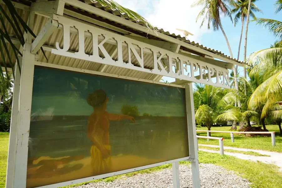
Another one on the roadside on the way to Laura, Jikin Keepen is an intriguing legendary site, where the myth of a giant who shaped the very land beneath your feet comes vividly to life through a striking roadside mural.
The legend centres on Tōl̗tōl̗ipāān, a powerful giant and youngest brother of Jemāluut and the trickster L̗etao, whose extraordinary strength saw him hurl rocks from Kūm̗ōōr all the way to Aur Atoll, creating the islets that dot the lagoon today.
Where the sand dunes rise just in front of the lagoon shore, it is said that the pressure of his foot pressed into the earth and pushed the surrounding land upward.
Unfortunately, the dunes are on private property and not accessible to visitors, but the large painted mural depicting the story is right there on the roadside and well worth a moment to stop and take in.
Lagoon Road, Ajeltake, Majuro. On the roadside, approximately 930 yards (850 m) east of the Ajeltake Gas Station and the United Church of Christ.
8.Site of the Marshall Islands' First Inauguration (Majuro)
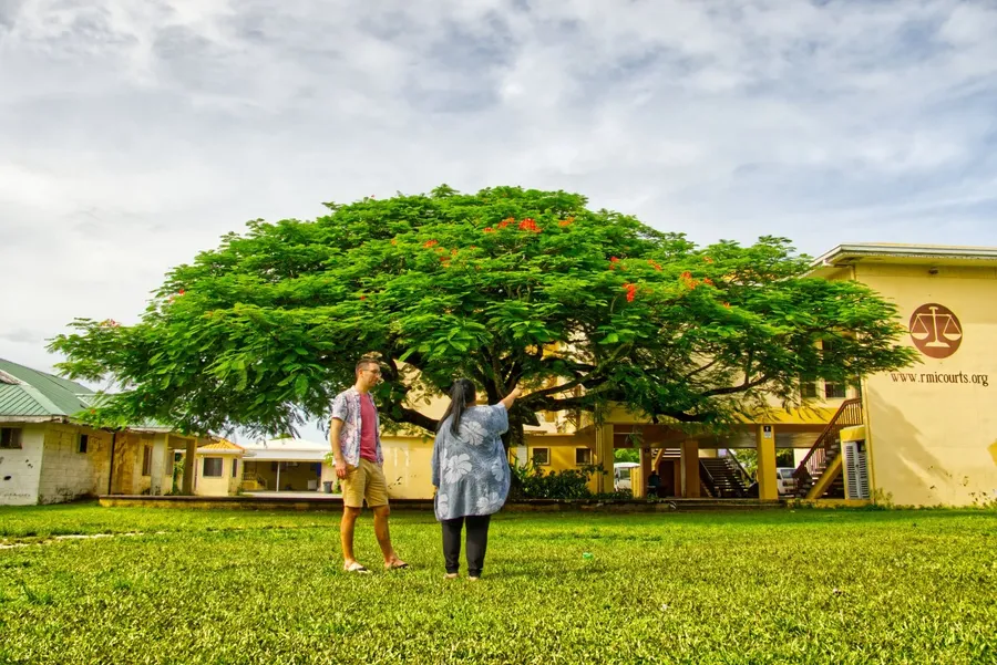
Standing in front of the Marshall Islands Judiciary building in Uliga, this small but historically significant park marks the site where the Marshall Islands' very first presidential inauguration took place.
On 1 May 1979, Iroij Amata Kabua was inaugurated as the first President of the Marshall Islands right here, in this open-air park, which was monumental in the country's journey to independence.
The park sits next to the Alele Museum and in front of the RMI Courts, making it easy to combine with other stops in the area. Flame trees line the grounds, adding a splash of colour and making it a worthy photo opportunity for anyone passing through.
Lagoon Road, Uliga, Majuro. In front of the RMI Court and across the road from Toeak Bar & Grill.
9.Alele Museum (Majuro)
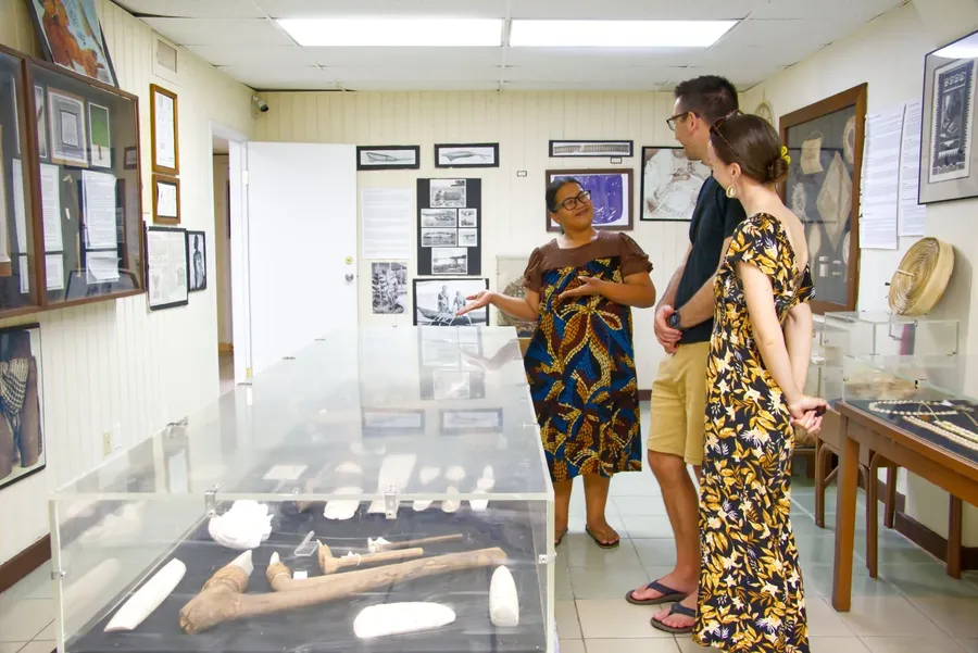
While not a historical site per se, the Alele Museum offers a deep dive into Marshallese history, culture and the sobering legacy of US nuclear testing in the Pacific.
Entry is free, as is the guided tour (there's a donation box if you'd like to contribute), and guides are a genuine wealth of knowledge. Inside, you'll move through rooms packed with traditional tools made from clam shells, outrigger canoes, navigation stick charts, finely woven jaki-ed mats and fishing instruments.
Four rotating photographic exhibits are on display, including images of chiefs and chieftesses from the German colonial period and a sobering record of the 67 nuclear detonations carried out on Bikini and Enewetak atolls between 1946 and 1958. The museum also houses the only public library in the Marshall Islands and a National Archive used by researchers across the Pacific.
For more indoor attractions, check out the 10 Things to Do in the Marshall Islands on a Rainy Day.
Uliga, Majuro. Next to the RMI Courthouse and across the road from Toeak Bar & Grill. The Museum is behind the roadside building.
10.Bikini Atoll
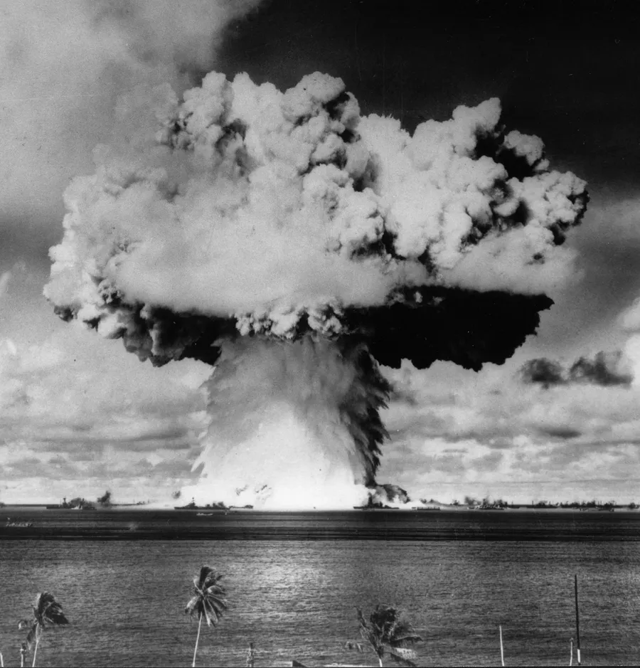
Bikini Atoll is one of the most historically charged and logistically demanding dive destinations on Earth, where a UNESCO World Heritage-listed lagoon holds an entire sunken fleet from the nuclear age.
Between 1946 and 1958, 23 nuclear devices were detonated here as part of US weapons testing programmes, including the colossal Castle Bravo test of 1954. The target ships anchored in the lagoon during Operation Crossroads now rest on the seafloor as extraordinary artificial reefs, among them the aircraft carrier USS Saratoga, the Japanese battleship Nagato and the battleship USS Arkansas.
Above water, the atoll feels hauntingly empty; abandoned structures and military remnants sit beneath thickening vegetation, and the original community remains displaced to this day.
This is strictly territory for experienced technical divers. Depth, decompression requirements and extreme remoteness rule out casual visits entirely, and all expeditions require advance permits, specialist operators and full self-sufficiency.
Bikini Atoll, northern Marshall Islands. Accessible only by private yacht, specialist liveaboard or expedition charter, typically departing from Majuro.
More About Historical Sites and Landmarks in the Marshall Islands
Now that you know some of the fascinating historical sites in the Marshall Islands, how about finding more through the following guides:
- 10 Best Cultural Activities in the Marshall Islands
- The Best Museums in the Marshall Islands
- Traditional Marshallese Food: 10 Foods to Try in the Marshall Islands
Finally, complete your itinerary with the 101 Best Things to Do in the Marshall Islands: The Ultimate List.

-S%20CREDIT%20MarshallIslandsPocketGuide.com-900x345.webp?v=2026-07-23T03%3A40%3A08.241Z)
-SEB%20CREDIT%20MarshallIslandsPocketGuide.com-900x506.webp?v=2026-07-19T00%3A06%3A29.505Z)